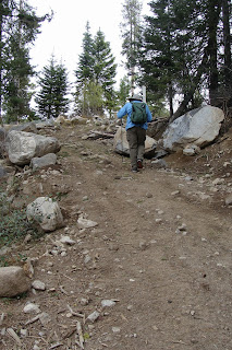
This is the sign that caught my attention as I traveled to and from the hospital when visiting my mom. A hiking trail in the middle of the city? Between subdivisions? Without any parking? Yep! There it was...all for me to explore.

What really intrigued me was the Richard Nixon Library. I had never been there, even though I had grown up in the area, went to high school and college there, and even worked on his first presidential campaign back in the 1970's . (I know.. I was young... and Republican... don't hold it against me!)
Before I left for home, I thought that I might have time for the short 2 mile walk (hike... I mean hike). It started out great, after I found a place to park my car about a mile away from the sign. The sun was out. People were few. And I was hiking!
 Evidently in the 1980's, after I was long gone from the area, the cities of Placentia, and Yorba Linda decided to create equestrian, bike, and hiking paths paths that followed the old rail road tracks. Tracks are long gone, and what is left are wide sections of land that have been converted into paths for horses, bikers, and hikers.
One of the things that make the first part of this hike so much fun for me, was seeing all of the vegetation that I left behind after moving to Idaho. Bougainvillea, lantana, yucca, eucalyptus, and pepper trees abound. But the orange trees with ripening fruit on them were the best! Unfortunately, I didn't get a picture of them.
 As I traveled along the El Cajon Trail, I passed several signs indicating that the Richard Nixon Library was 2.0 miles, which made me nervous. No matter how long I hiked, I seemed to be 2 miles away from the library - not a good sign when you have to catch a flight... So I walked faster!
The further I went, the less "pretty" and less "directional" the signs became. I was on a path, for sure... but was I on the "right" path? Was I headed in the "right" direction? And was the Richard Nixon Library still 2 miles away? I wasn't certain.

So I turned on the GPS on my phone, and plugged in the Richard Nixon Library. Low and behold... it gave me driving directions, which didn't help much, as I was on a hiking path not on Google Maps.
So like any good hiker, determined to find the destination which first precipitated the hike... I marched on.
With my GPS beeping wildly, I rounded the bend and there it was...Tricky Dick's very own helicopter! Wow. I reached in between the rod iron fence and snapped this shot of his presidential helicopter!
With excitement mounting, and little time left before I had to head off to the airport, I walked up to the front door of the Richard Nixon Library and Archives to snap this picture...
Oh well, guess it wasn't meant to be. Not this time anyway. I wondered why I only saw one homeless woman in the parking lot, and one security guard ... that I chatted up as I walked the perimeter of the building trying to get some info, a personal tour, anything? Too bad. The security guard said "Enjoy the outside", as he headed inside.
With my final destination reached - I headed back to the car. According to Endomondo, I hiked for a total hike of 5.5 miles! So much for "pretty" signs. I did, however, make my flight - so it was a good day!
And thanks to the Republicans...it wasn't even crowded! They sure know how to clear a national park!


