Thursday, October 24, 2013

Hike # 31: What does Rose Drive, Richard Nixon, and a Government Shutdown have in common?

My 31st hike!

This is the sign that caught my attention as I traveled to and from the hospital when visiting my mom. A hiking trail in the middle of the city? Between subdivisions? Without any parking? Yep! There it was...all for me to explore.


What really intrigued me was the Richard Nixon Library. I had never been there, even though I had grown up in the area, went to high school and college there, and even worked on his first presidential campaign back in the 1970's . (I know.. I was young... and Republican... don't hold it against me!)

Before I left for home, I thought that I might have time for the short 2 mile walk (hike... I mean hike). It started out great, after I found a place to park my car about a mile away from the sign. The sun was out. People were few. And I was hiking!


Evidently in the 1980's, after I was long gone from the area, the cities of Placentia, and Yorba Linda decided to create equestrian, bike, and hiking paths paths that followed the old rail road tracks. Tracks are long gone, and what is left are wide sections of land that have been converted into paths for horses, bikers, and hikers.

One of the things that make the first part of this hike so much fun for me, was seeing all of the vegetation that I left behind after moving to Idaho. Bougainvillea, lantana, yucca, eucalyptus, and pepper trees abound. But the orange trees with ripening fruit on them were the best! Unfortunately, I didn't get a picture of them.

As I traveled along the El Cajon Trail, I passed several signs indicating that the Richard Nixon Library was 2.0 miles, which made me nervous. No matter how long I hiked, I seemed to be 2 miles away from the library - not a good sign when you have to catch a flight... So I walked faster!

The further I went, the less "pretty" and less "directional" the signs became. I was on a path, for sure... but was I on the "right" path? Was I headed in the "right" direction? And was the Richard Nixon Library still 2 miles away? I wasn't certain.

So I turned on the GPS on my phone, and plugged in the Richard Nixon Library. Low and behold... it gave me driving directions, which didn't help much, as I was on a hiking path not on Google Maps.

So like any good hiker, determined to find the destination which first precipitated the hike... I marched on.

With my GPS beeping wildly, I rounded the bend and there it was...Tricky Dick's very own helicopter! Wow. I reached in between the rod iron fence and snapped this shot of his presidential helicopter!

With excitement mounting, and little time left before I had to head off to the airport, I walked up to the front door of the Richard Nixon Library and Archives to snap this picture...
Oh well, guess it wasn't meant to be. Not this time anyway. I wondered why I only saw one homeless woman in the parking lot, and one security guard ... that I chatted up as I walked the perimeter of the building trying to get some info, a personal tour, anything? Too bad. The security guard said "Enjoy the outside", as he headed inside.

With my final destination reached - I headed back to the car. According to Endomondo, I hiked for a total hike of 5.5 miles! So much for "pretty" signs. I did, however, make my flight - so it was a good day!

And thanks to the  Republicans...it wasn't even crowded! They sure know how to clear a national park!

Monday, October 21, 2013

Hike # 30: Hospital Hike...A Turning Point

Nothing makes you travel faster (by land, by air, by rail, or by car) than when your parents are in crisis. That is what precipitated Hike # 30: The Hospital Hike. This hike was not only a half way point to my 60 hike goal - it was transformative, reflective, hard, and life changing - for more than myself.

Mom fell on October 7th, after a simple dental cleaning. She tripped on a rise in a cement walkway - directly across the street from the hospital. Sadly, at 84 years old, that fall meant a broken humorous, a fractured nose, renal compromise due to shock, and anemia due to blood loss through extensive bruising. All of that ended my mother in the hospital for 7 days, only to graduate to skilled nursing care. All said... "It sucks to be old!" She would agree.

So, when I needed a break from the hospital care,  I decided to take a hike. A Hospital Hike! Around the perimeter of the hospital I went. I set Edomondo at the emergency room entrance. I charted my course around the hospital block and started on a hike that took me back to my teen age years.
I grew up in this area. It had changed since 1971, when I graduated from high school. I remember driving down Yorba Linda Boulevard in my 1968 black VW bug. While walking (hiking) past this particular strip mall (just around the corner from the hospital), I remembered hurriedly speeding down the road while in college, only to hit a cat, as it ran across the road. Skipping class, I spent hours searching bushes, and knocking on neighborhood doors, trying to find the cat.

That was a traumatic memory from my early college days. But it did not compare to the trauma I felt after seeing my black, and blue bruised, and broken mother in pain in the hospital bed. Nor did it compare to the overwhelming grief I felt as I  wheeled my father to visit her. It was at this moment that I realized that not only would their lives would never be the same, neither would mine.

This tragic fall, led me to take my 30th hike - a hike  that took something more than physical strength, and endurance - it took emotional fortitude, soul seeking, and a whole lot of other things I can't even describe.

Past the strip mall, to the corner. Down the west side of the hospital, I traveled, navigating various rock formations, raised cement, uneven walkways, and assorted other urban hazards. And then I found it. The exact place that my mother fell. It wasn't any higher than 3/4".

But this 3/4" took down a woman that was more stubborn than a mule, feistier than Scarlet O'Hara, and who had a child-like side that rivaled Willie Wonka. It was tragic for her, and  for all of us who knew it was only a matter of time. This was to be the end of  one phase of life and the beginning of another.

After the hike I knew, that I had to move my parents out of their home of 50+ years into a safer place. A place my mother would hate; but one that my father would accept. A place where one sibling would hold me in contempt; but the other would breathe a sigh of relief. A place that would only accept one of their three pets; but would mean finding a way for the others to visit. A place that would assure three meals a day, medicine management, social interaction, and everything a daughter would want for her aging parents; but would ultimately never be a home for them.

Lesson from the Hike # 30, the smallest event can change your  life forever - and sometimes that change isn't pleasant.

Endomondo Stats:
.85 miles
22 minutes
Life changing...and it sucked!


Monday, October 7, 2013

Hike # 29: Rabbit Run

Now that I have almost arrived at the half way point of my 60 hikes, good friends, and family members have been so encouraging. Inviting me on hikes, finding new places to go, and generally giving me the motivation to make it to the finish line. Today, my good friend, Linda, did just that!

This woman is amazing! Although only slightly older than me, she has run marathons, faithfully attended a woman's Boot Camp, tirelessly helps her husband work their 15+ acres of land, and has more energy that I could possibly imagine.  Taking a brief time out for her feet to heal from her exercise routines, she thought that joining me for a hike once a week was exactly what she needed to restore her exercise regiment and strengthen her feet. She was exactly what I needed!

So off we went... to another part of the Boise Foothills I knew nothing about... the Idaho Velodrome, in Eagle.We started at Rabbit Run and only had a short amount of time for the hike - about an hour. In fact, I will have to resolve to turn off my cell phone - coverage is so good that I got calls from my office. 


Intersecting with D's Chaos, we took a trail that had some great views of the Treasure Valley, just bursting with fall. The trees were starting to turn. Lovely autumn colors mixed with lush green - it was a sight to behold! This is the best time of the year to hike in Boise!


When you look over the numerous trails that this area has to offer, you realize that this one section of the foothills could accommodate several hikes. So, Linda and I made a plan to hike each of the trails.


Today, we hiked for 3 miles in 43 minutes! Linda had run these hills for training, so we made quick work of the ups and downs that Rabbit Run and D's Chaos had to offer. Next Wednesday, we will attempt the longer hikes.... and I might even leave my cell phone in the car!


Sunday, October 6, 2013

Hike # 28: Five Mile/Orchard Gulch

What a beautiful October day! 71 degrees, blue skies, no wind - just perfect!

Erik ( of Erik's Fly Fishing Blog
http://flyfishingboise.blogspot.com/), and his wife Jessica (a.k.a. Gracey) invited me on a Sunday hike in the Boise Foothills. What made this hike so special was that I married this couple. That's right,  Reverend Roxie married Erik, and Jessica on May 26,2012. Now, they are my hiking buddies!

Here is another thing that is amazing about this hike. After living in Boise since 1994, I never knew this part of the town existed. We drove down State Street to Fort, then turned left onto Reserve. Who knew Reserve even existed?

After all of those trips to downtown St. Luke's Hospital for babies born, emergency room visits, surgical  prayers, and Mert's heart surgery... I never ever noticed that street. But today, we took it - because we were going on a hike!

Reserve Street took us to Shadow Mountain Road, which took us to a dirt road, and then to the trail head called 5-Mile Gulch. The problem was that we didn't actually see that trail head, and  started up an unmarked path, assuming it was the right one... which we did get right - yeah "Fate and Good Fortune" - or Divine Guidance (which I prefer).

So here is the best part... it was beautiful! Fall in the Boise Foothills is beautiful, and wonderful ,and invigorating, and a fantastic place to "step it up a notch". Most of my hikes have been easy; in fact, I sought them out. This was a "moderate" hike. So... I stepped it up in challenge, and in length. Endomondo recorded it at 5.94 - I'm rounding it up to 6. It was for all intensive purposes it was a 6 mile moderate hike - and I was (to put it in 60's vernacular) stoked!

During the hike, we saw so many fun things, and I have lots of commentary on all of them; however, Erik's photos really take me back to the beauty, the challenge, and the fun of the day. So, thanks to Erik (better check out his blog), I have a photo montage of the day. Thanks Erik! Thanks Jessica! It was a great day!

Enjoy the pictures, and imagine the hike.


Still trusting....


Trusting this is the right trail!

The cairn, defined as a mound of stones
built as a landmark  implies that it is...


Forgetting about trust ... I was just enjoying the journey.


Erik and Jessica

Assurance at last... we were on the right trail! 5-Mile Gulch!

We encountered mountain bikers.

Hitch hikers in the form of burrs.

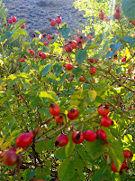
Bear scat... filled with rose hips.

Willow tunnels.

Assorted wildlife including birds of prey, song birds, unidentifiable insects
( Mormon Cricket? Cicada? Mutant Grass Hopper?), and a baby rattle snake!

In the end... we found the trail head and I drove home with a great sense of satisfaction and delight. What a great hike!